System Overview:
The grassland fire prevention system employs an intelligent dual-spectrum recognition system—combining visible-light smoke/fire detection with infrared thermal imaging for temperature-based detection—along with cameras, telephoto lenses, and backend monitoring software to intelligently detect smoke and fire and trigger automatic alarms. It utilizes the azimuth and tilt angles of heavy-duty digital pan-tilt units, the focal length of telephoto lenses, and a backend GIS management platform to automatically and precisely pinpoint fire locations. Additionally, it functions as an intelligent forest fire video surveillance system that transmits video footage and control signals via cameras and transmission links to a command center for monitoring, storage, and management.
The grassland fire early warning system consists of front-end monitoring base stations, a transmission network, a backend monitoring and management platform, and an output display system; the system architecture is illustrated in the figure below:

Structure Diagram of the Grassland Fire Prevention and Early Warning System
Front-end monitoring and lookout tower system:
The front-end monitoring base station primarily comprises a video acquisition system, an intelligent dual-spectrum smoke and fire recognition system, a wind-solar hybrid power supply system, an anti-theft alarm and intercom system, a base station control system, a meteorological data collection system, a lightning protection and grounding system, and a tower infrastructure system. It serves as a critical site for capturing front-end video imagery, identifying smoke and fire in the grassland (triggering automatic alarms), and collecting data for the automatic localization of smoke and fire sources.
(1) Video Acquisition System
a. High-definition (HD) defogging camera
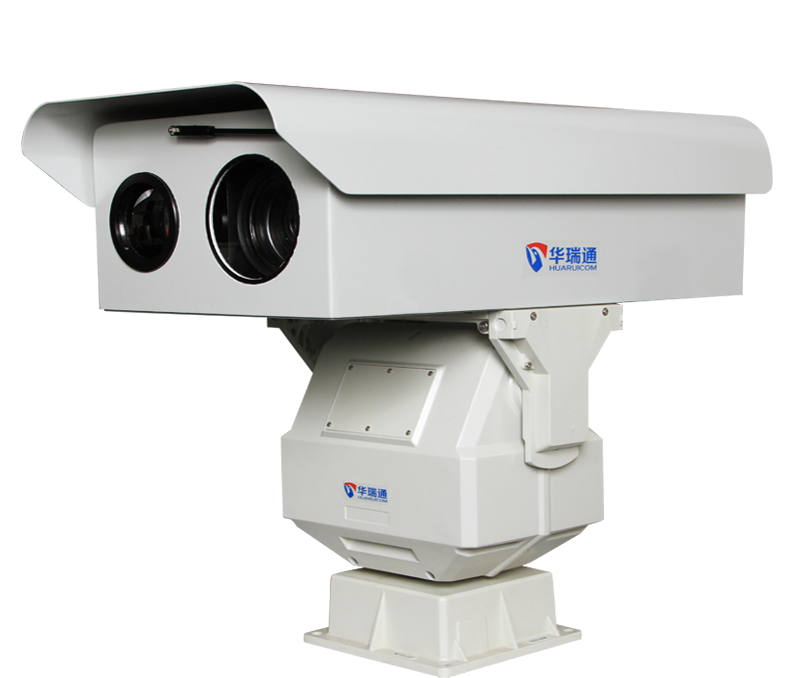
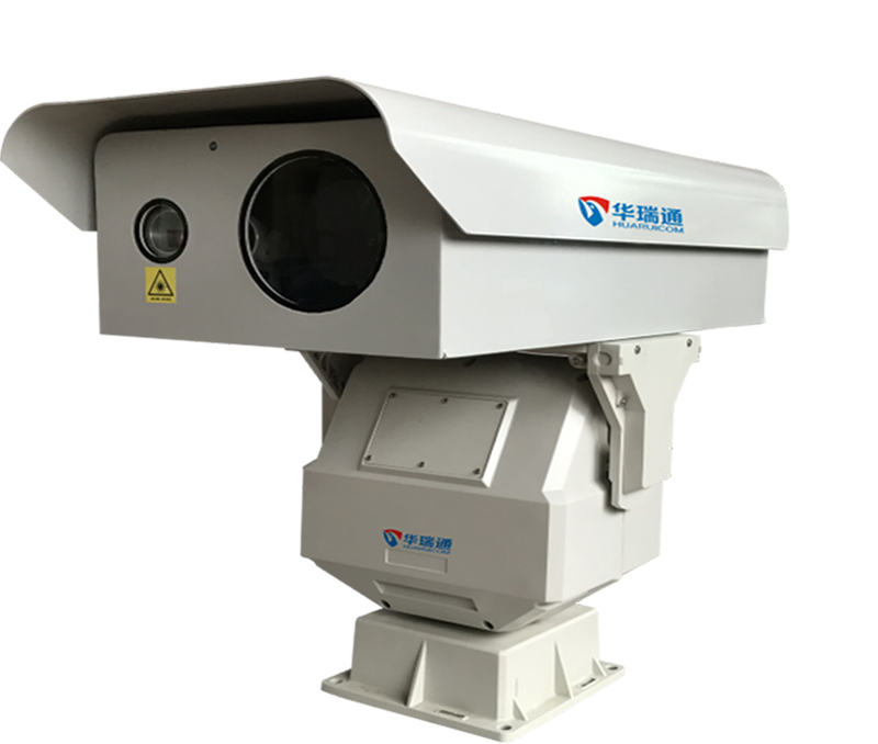
The HD defogging camera is a key imaging device for video acquisition; it captures front-end images, encodes them, and transmits them to the back-end for display. As grassland fire prevention requires 24-hour surveillance, the camera must support day/night modes. Additionally, to meet observation requirements during foggy conditions, the camera must feature defogging capabilities.
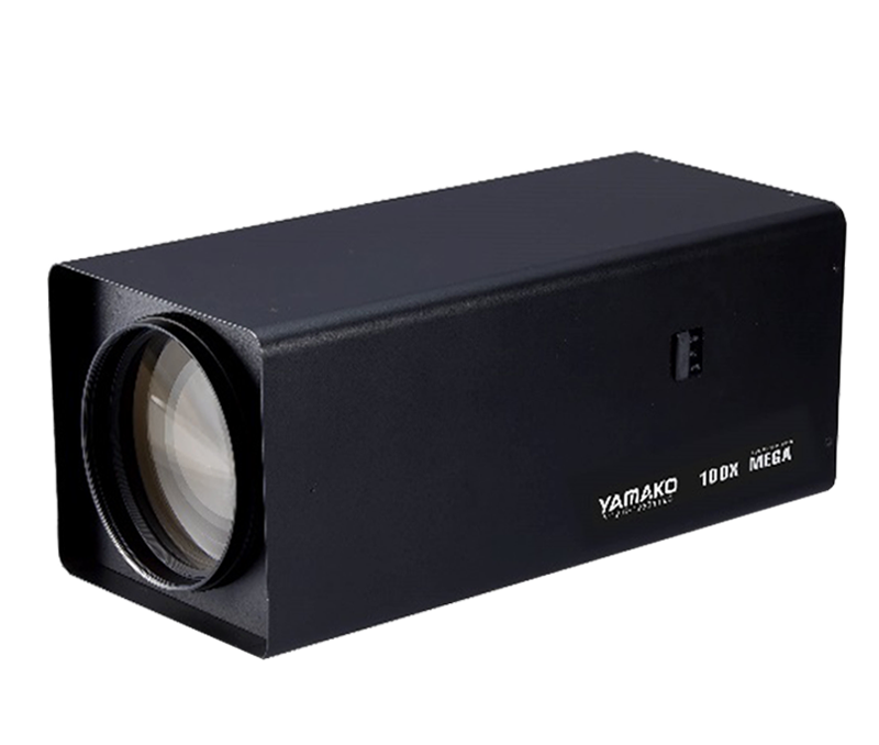
b. Telephoto lens
Depending on the scope of the grassland fire monitoring area, telephoto motorized zoom lenses with varying focal lengths are selected to meet the need for wide-area, broad-field surveillance. Generally, a lens with a focal length of ≥300mm is used for a 3km monitoring range, ≥500mm for a 5km range, and ≥700mm for an 8km range.
c. Large outdoor protective housing
Since the front-end base stations for the grassland fire prevention system are located in the field, large outdoor protective housings are required to shield the cameras and telephoto lenses. Enclosing the camera and lens within such a housing is essential for ensuring continuous, 24-hour intelligent monitoring. Designed to withstand harsh outdoor weather conditions, these large housings meet the IP67 protection standard and offer resistance to fire, rain, wind, moisture, and corrosion, while also providing temperature control.
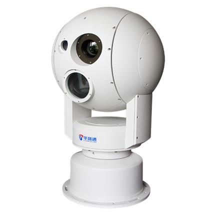
d. Heavy-duty digital Pan-Tilt Unit (PTU)
Front-end base stations are typically situated at high elevations in forest areas where strong winds can easily cause the mounted cameras to sway, resulting in image instability. To meet the demands of forest surveillance, a heavy-duty digital PTU is used to mount the camera and telephoto lens, thereby preventing sway. Furthermore, given the extensive monitoring range required for grassland fire prevention, the PTU must support wide-range coverage—specifically, 360° horizontal rotation (azimuth) and a tilt range of -45° to +45°—to effectively meet operational requirements. The long-range lenses equipped in the grassland fire prevention system enable monitoring over a range of several kilometers. Such long-distance surveillance places high demands on the operational precision of the heavy-duty digital pan-tilt units; superior precision ensures smooth transitions in the video feed during long-range monitoring, preventing image discontinuity in distant forest or grassland areas.
As an intelligent early-warning system for grassland fire prevention, the heavy-duty digital pan-tilt unit must support both automatic and manual inspection modes. In routine operation, the system controls the unit to conduct 24/7 automatic patrols based on presets configured by the administrator. When suspicious activity arises, the administrator can manually direct the unit to the specific area requiring observation. For large-scale, long-range grassland monitoring, a higher number of presets is advantageous; an extensive set of presets is crucial for ensuring comprehensive coverage across the vast areas requiring protection.
To enable the automatic localization of fire sources within the early-warning system, the heavy-duty digital pan-tilt unit must possess positioning capabilities, working in conjunction with backend GIS platform software to pinpoint the location of fires.
(2) Intelligent Dual-Spectrum Fire Early-Warning and Recognition System
The intelligent dual-spectrum recognition system constitutes the core and most critical function of the grassland fire early-warning system. It facilitates the transition from traditional, manual grassland monitoring to intelligent, automated surveillance. Automated monitoring systems enhance operational efficiency and reduce the risk of missed detections caused by human oversight. These intelligent systems provide 24/7 monitoring; upon detecting suspected smoke or fire, the system immediately alerts users via an alarm platform and provides real-time on-site information, enabling rapid assessment and the immediate implementation of emergency response measures.
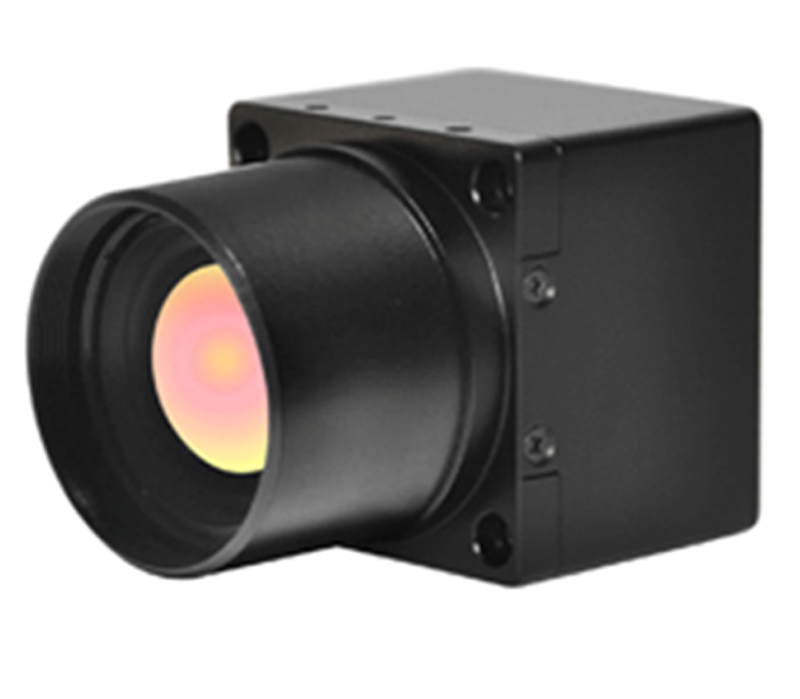
The intelligent dual-spectrum fire early-warning and recognition system comprises two main components: an intelligent smoke and fire recognition processor that analyzes video footage from the monitored area, and an infrared thermal imaging recognition system that detects fires by identifying thermal radiation and temperature differentials between targets.


An intelligent smoke and fire recognition processor—based on the analysis of video surveillance imagery from the grassland area—allows monitoring centers to view the site conditions intuitively and realistically via remote video feeds. It effectively identifies smoke and fire under conditions of good visibility, even when the fire originates within the grassland itself; however, during smoggy weather, low visibility can result in unclear video images, potentially leading to failures in correctly identifying smoke or fire.
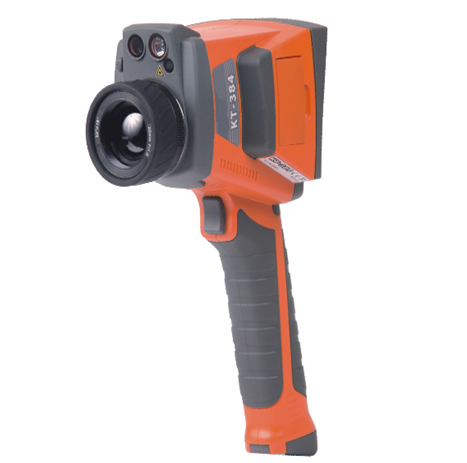
Infrared thermal imaging systems detect thermal radiation and generate real-time grayscale images based on temperature differences between targets. While they do not provide a realistic visual representation of the grassland's appearance, they are unaffected by smog, enabling all-weather detection. However, they require an unobstructed line of sight; for instance, if a fire breaks out within a wooded area, tall trees may block the view, preventing accurate surface temperature measurement and detection.
By analyzing the strengths and weaknesses of these individual systems, a dual intelligent recognition system—combining video-based smoke and fire analysis with infrared thermal imaging based on temperature difference detection—can effectively overcome the limitations of single-system approaches. This significantly enhances the capability to intelligently detect smoke and fire in grasslands, facilitating a highly efficient, all-weather, year-round early warning system.
(3) Power Supply System
The system utilizes either mains power or a wind-solar hybrid power supply. In the case of the wind-solar hybrid setup, the system is designed to ensure normal operation for three consecutive days during periods of overcast or rainy weather.
(4) Anti-theft Alarm and Intercom System
Most front-end base station equipment for the grassland fire warning system is installed in remote, unmanned areas, necessitating anti-theft measures. To secure these field monitoring stations, the system employs security cameras with motion detection capabilities to trigger automatic anti-theft alarms, alongside a two-way voice intercom system to serve as a warning and deterrent. The anti-theft alarm system operates as follows:
A digital alarm control unit is installed to process the video feed from the security cameras. Alarm triggers—such as perimeter intrusion or object removal—are configured based on the camera's dynamic imagery to ensure the security of the front-end base station equipment. If anyone approaches or climbs the base station tower, the alarm system activates; security cameras transmit footage to the monitoring center for real-time recording, while loudspeakers broadcast an audible warning on-site. Upon receiving the alarm signal, the monitoring center immediately issues verbal warnings via the intercom system.
A higher-level monitoring and command center can establish one-way voice communication with the site via the intercom system and monitor on-site audio.
Remote control software at the monitoring center allows for the remote operation of the base station's electronic surveillance equipment, including PTZ mechanisms, cameras, and lenses.
Video motion detection can be employed to suit the unique natural environment of the grasslands, working in conjunction with on-site alarm devices and an intelligent early-warning monitoring platform.
(5) Base Station Control System
As base station equipment operates in the field—comprising components such as fire and smoke detection systems, digital alarm control panels (for anti-theft), power amplifiers, control circuits, encoders, and network switches—standard electronic devices often fail to function reliably under harsh outdoor conditions. To ensure the long-term, stable, and reliable operation of the grassland fire early-warning system, an integrated control unit is required; this design houses the intelligent monitoring equipment within a waterproof, temperature-controlled enclosure. Designed specifically for the grassland fire prevention and early warning system, the base station control system features an integrated design with the following functions:
1. Ingress Protection: IP66 rating
2. Data exchange module: 4 RJ45 inputs, 1 RJ45 output
3. Power conversion module: AC 180V–240V to DC 24V
4. Remote control module: Software-based remote control for DC 24V power switching (cut-off and supply)
5. Remote temperature and humidity monitoring module: Collects data and transmits it via the network to the command center for software display
6. Temperature control module: Automatically activates fans above 35°C and heaters below 0°C (thresholds are adjustable)
7. Lightning protection module
8. Interfaces: RJ45, DC 24V, DC 12V
(6) Lightning protection and grounding system
For remote grassland fire monitoring base stations, lightning protection and grounding are essential for ensuring the safety of the station and its equipment. The system comprises two parts: grounding for the base station tower and grounding for the base station equipment. In accordance with national standards, the grounding resistance must be less than 10Ω for the tower and less than 4Ω for the equipment.
Tower grounding components: Lightning rod and a grounding system with resistance <10Ω.
Equipment grounding components: Lightning protection for power supplies, signals, and wireless equipment, plus a grounding system with resistance <4Ω. A shared grounding method is adopted here, where the shared system resistance is <4Ω; both the tower lightning rod and the equipment are connected to this system. However, the grounding connection points for the tower and the equipment must be separated by a distance of 10 meters to ensure a shared grounding system without sharing the exact connection point.
(7) Tower infrastructure system
Equipment installation utilizes a newly erected pole with a height of 15 meters.
(8) Transmission network
The system employs a wired, digital transmission network based on IP technology, utilizing the newly installed communication fiber-optic cables and computer network to carry data for the grassland fire prevention and early warning system. Grassland fire prevention and early warning field units connect to nearby switches, transmitting signals to the command center via a computer network.
(9) Backend Monitoring and Management Platform
The backend monitoring center comprises network access components, a video surveillance management platform, a GIS platform, management servers, storage servers, alarm and intercom equipment, monitoring and alarm client terminals, image workstations, a command center video wall, and auxiliary support systems. It enables centralized remote monitoring of the grassland fire prevention and early warning system. Through the transmission network, it facilitates data acquisition, analysis, fire point localization, automatic alarming, and command dispatching. The center's video surveillance management platform software includes the following management and service functions:
(1) Center Management Module Functions
a Identity authentication and access control
b Organizational management
c Device management and monitoring
d Control command management
e Backbone routing management
f Log management
(2) Streaming Media Service Module Functions
a Management of streaming media forwarding services across monitoring centers
b Distribution restriction management policies (e.g., stream counts, user priority, event priority)
(3) Remote Management Module Functions
a Remote image preview
b Remote configuration and maintenance
c Remote control
d Remote playback
e Remote backup
f Remote monitoring auxiliary functions
g Support for IE client configuration interface
(4) Alarm Management Module Functions
a Simultaneous display of visible-light video and thermal imaging (grayscale) images
b Data exchange of fire point coordinates with third-party GIS databases
c Alarm source management: Linking video recording channels to frontend alarm sources for arming/disarming and setting alarm protocols
d Intelligent dual-spectrum recognition and alarm processing
Dual recognition: Simultaneously detects fire points and hotspots; the system locks onto the target and immediately sends an alarm signal.
Smoke/fire recognition first: Detects a fire point and triggers an alert; the system locks onto the target and initiates thermal imaging detection. If thermal imaging detects a hotspot, an alarm signal is sent immediately; if not, the system switches to manual notification.
Thermal imaging first: Detects a hotspot and triggers an alert; the system locks onto the target and initiates smoke/fire recognition. If the smoke/fire system detects a fire point, an alarm signal is sent immediately; if not, the system switches to manual notification. (10) Firefighting Command and Management System
The GIS intelligent monitoring system seamlessly integrates with digital PTZ (Pan-Tilt-Zoom) units and the Geographic Information System (GIS). It feeds the angles returned by the digital PTZ units into the GIS to achieve precise coordinate positioning. Based on real-time data from the front-end control system—specifically the PTZ's horizontal rotation angle, vertical tilt angle, and lens focal length—and combining these with the longitude, latitude, and elevation of the monitoring point, the system calculates the precise location (longitude, latitude, and elevation) of the fire source and marks it on the GIS map.
Smoke and Fire Spread Analysis System
1. Fire Spread Dynamic Prediction Software: Supports dynamic analysis and prediction of fire spread direction, fire area, fire boundaries, and spread velocity. 2. Fire Source Localization Software: Supports automated tracking and locking of fire source locations through integration with smoke/fire detection and recognition/alarm software, and enables the display and tracking of these locations on the GIS platform.
2. Fire Source Analysis and Management System
Fire Source Impact Analysis Software: Supports querying and analyzing the impact of a fire source on surrounding equipment and facilities based on specific radii or zones, and displays this information on the map. 2. Statistical Result Output Software: Supports outputting and printing fire source analysis results in formats such as Excel reports or statistical charts.
3. Firefighting Route Analysis System
1. Optimal Route Analysis Software: Supports the analysis and calculation of optimal routes for firefighting command and management. 2. Route Information Query Software: Supports dynamic queries regarding road conditions, trafficability, and facilities along the optimal route. 3. Route Traversal Time Prediction Software: Supports dynamic prediction of the time required to traverse the optimal route.
4. Disaster Loss Assessment and Management System
1. Fire Area and Scope Assessment Software: Supports calculating and assessing the fire area and boundary scope based on real-time dynamic imagery from automated smoke/fire detection and recognition systems. 2. Disaster Loss Assessment Report Output Software: Supports the timely or on-demand output of current forest resource disaster loss assessment data or predicted assessment results in report format.


 SolutionSolution
 Hot Products
 Video
Video

 Contact information